Overview
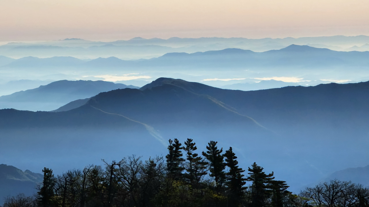
Korean mountains are not very high, but their terrain creates a surprisingly steep and direct hiking style. Because peaks are compact and elevations are modest, most routes go straight toward the summit rather than contouring around mid-slopes, as is common in Europe or North America. This structural difference results in more ridges, rocky sections, and repeated ups and downs, with fewer gentle traverses.
As a result, Korean hikes often feel demanding even when the distance is short. Expect steep stair sections, rocky ridges, and frequent climbs and descents—features shaped by Korea’s sharp terrain.
Despite the physical challenge, trails are well-marked, rescue services are reliable, and national parks enforce clear rules and operating hours, creating a structured and predictable hiking environment. Overall, Korean hiking is distinct from Western alpine trekking while still being accessible as a day hike from most major cities.
Key traits of Korean hiking
- Short mountains, steep terrain: Peaks are not high, but slopes rise sharply.
- Summit-focused routes: Trails climb directly upward rather than traversing mid-slopes.
- Ridges and rocky paths: Ridge walking and stone sections are common.
- Harder than the distance suggests: Frequent ascents and descents increase difficulty.
* In Korea, mountain climbing is called "deungsan" or "sanhaeng". For this article, we use "hiking".
Key Characteristics
Korea’s mountains are not very high, but they are everywhere and easy to access. Hiking in Korea usually means going to the summit, so most trails include summits and sometimes ridge routes. Here are some important features of hiking in Korea.
🛡 Safety and Rescue (phone_in_talk119)
The major trails are well-maintained and stay close to the main route. As long as you follow the marked path, it is easy for rescue teams to reach you. If needed, you can call 119, and rescue teams can arrive in most areas within about 30 minutes. When a phone signal is weak, you can try sending a text message. All rescue services—including helicopter rescue—are free and covered by the government.
It helps to carry a spare phone battery and keep mobile data/GPS turned on.
money_offNational Park entrance is free
Entry to all Korean National Parks is free. Parking, park shuttles, cable cars, and campsites may charge separate fees. Some routes may require reservations or have daily visitor limits during peak seasons, so check park notices in advance.
Private attractions outside the national park boundary are not included in this. Fees vary by area.
🏔 Highest Peaks (1,950m)
Korea’s highest mountain is Hallasan (1,950m) on Jeju Island, followed by Jirisan (1,915m). There are about 120 mountains higher than 1,100m.
Korea has no permanent snow or glaciers.
(Hallasan 1,950m, Jirisan 1,915m, Seoraksan 1,708m, Deogyusan 1,614m)
⛰ Steep & Rocky Trails
Most trails climb steeply toward the summit. Ridge lines often have many ups and downs because peaks sit close together. Expect rocky paths, stone steps, and steep slopes, often passing through scenic forests.
Proper footwear and trekking poles are highly recommended. Downhill can be more difficult than uphill.
🏠 No mountain lodges, only shelters
Some national parks have large shelters where hikers may stay overnight. Shelters are very basic and mainly for emergencies.
Amenities are minimal—you must bring your own food, snacks, and water.
There are no beds, private rooms, showers, or cooking facilities. Simple meals or drinks may be sold.
Non-major mountains sometimes have small shelters, but they also have no real facilities.
🥾 Day Hike Profile
Most Korean hikes are half-day hikes. Many trails take 4-8 hours (5-15 km) round-trip. Including travel time, a typical hiking day becomes 10-15 hours.
In Korea, even many long trails can be completed in one day. Some hikers start early in the morning and return the same day.
Some national parks allow overnight stays in shelters. On large mountains, hikers sometimes stay for one, two, or three nights.
🤝 Mountaineering Clubs
Many Korean hikers join clubs that organize regular group trips. Participants book a seat on a chartered bus that goes directly to the trailhead.
Hikers must be able to keep up with the group’s pace and meet on time.
A typical one-day trip costs about 50,000–60,000 KRW. The first time, you may need help from a Korean speaker to join. Simple Korean phrases are useful.
📌 Other practical notes
- Mobile coverage is available on most trails.
- Cooking with open flames is not allowed except in shelters.
- Drinking and smoking are banned on many mountains.
- Water is available only at certain shelters or rest areas.
Phone charging may be possible at some national park shelters.
Hiking by Season
Korea has four relatively distinct seasons, offering completely different experiences depending on the season. For example, in winter you can see beautiful snow-covered landscapes.
🌸 Spring
Ideal for hiking. See flowers and buds.
Because wind and temperature can change greatly, you should check the weather forecast and make plans. And bring a thin long-sleeved and light windbreak.
If you are going to a high mountain like Hallasan or Seoraksan, it is a good idea to prepare a outerwear that will keep you warm.
☀ Summer
The weather is hot and humid, and the dense forests spread out. Hiking can be quite physically demanding.
In summer, choose shorter trails that include streams, where you can cool off in the stream water.
Be careful on slippery mountain paths immediately after heavy rain.
Be careful, as many valleys downstream are off-limits.
🍁 Autumn
It's the perfect season for hiking. You can enjoy the cool, refreshing air and colorful autumn foliage.
In autumn, you should be prepared for sudden weather changes. In high altitudes, it's a good idea to pack extra layers.
The mountains in Korea have completely different scenery depending on the four seasons, and each has its own charm, but autumn is especially beautiful.
Peak times can be crowded so start early
❄ Winter
Snowy peaks, Serene landscapes of a completely new world.
Winter mountain winds are strong, and exposed ridge trails often feel like temperatures drop below -20 degrees Celsius.
Major mountains can be enjoyed without any danger in the winter, if they are not off the path and are basically prepared.
Be sure to prepare the necessary equipment, including crampons, waterproof hiking boots, and several layers of warm clothing. Also, be prepared for early sunsets (the days are short).
Major Mountains & Signature Trails
Compare difficulty, seasons and distance for Korea’s major mountains, then jump to detailed trail guides.
Find the Best Trail for You
Filter Korea’s major trails by mountain, distance, difficulty, and season – then pick the hike that fits your day.